Thursday, August 27, 2020

N. Scott Momaday, quoted by Barry Lopez (Arctic Dreams) on Place


 "Once in his life, a man  ought to concentrate his mind upon the remembered earth. He ought to give himself up to a particular landscape in his experience; to look at it from as many angles as he can, to wonder upon it, to dwell upon it.

                                                             ________________

He ought to imagine that he touches it with his hands at every season and listens to the sounds that are made upon it.

                                                           _________________

He ought to imagine all the creatures there and all the faintest motions of the wind. He ought to recollect the glare of the moon, and the colors of the dawn and dusk."

M. Scott Momaday


Saturday, August 8, 2020

Arizona Trail: Passage 40

Kaibab Plateau--South

We hiked this passage in two trips: on June 7-8, 2008, with Richard and my nephew Brandon, from Telegraph Hill to Dog Lake/East Rim Overlook, and on May 19, 2012, with Richard, and Brandon's brother Justin.  Here are the notes from the two trips:

6-7-08

Off at 9:30 [from Telegraph Hill], walked through burn for the first hour.  After the burn area, it was a lovely spruce/Ponderosa/Aspen forest, with great meadows and lakes.  At 12:15, the temperature was about 70 degrees.  There was still snow on the ground (see above).  At the 6/7 camp, there are seep tanks circa 1/8 mile west of the trail, with better water than the "cloudy pond" mentioned in the trail description.  Night temperatures below 50 degrees (estimated), with little wind.

6-8

After camping for the night near a seep (panorama above), we continued through the evergreen forest, with a highest elevation reached of 8860 feet.  The evergreen forest was interspersed with stands of aspen. The trail has relatively little elevation change, but the altitude (from Phoenix at 1000 feet) makes the hiking harder.  There are beautiful meadows with tanks and lakes, though at inconvenient intervals for backpacking camps.  The view of the northeastern side canyon of the Grand Canyon is spectacular.

We left the Arizona Trail at Crystal Spring to deal with Brandon's severe blisters.

June 18-19, 2012

We got into the East Rim Viewpoint camp (Forest Road 611) about 6:30 p.m.on a windy, cool day.  Made camp (it looks legal) near the AZT, a mile and a half or two from where we had to bug out with Brandon.

We'd had a good trip up, with a stop at Navajo Bridge.  We had a great dinner at Jacob Lake, and pulled in at about 6:15. . . . My night seemed OK, but I woke up nauseous. . . . I decided to hike anyway, actually starting from the National Park entrance ranger station, where we left the red truck. It was a great hike, first going to a fire tower, then down into parks and forests.  Interestingly, the forests are kind of messy, even after an old burn. It looks as though people have spent a fair amount of chainsaw time logging the burnt forest.

But the parks (meadows) are great--and it's deceptive how big they are.  You can go for 1/2-3/4 of a mile through just one park. . . . [problems with nausea, here and later in camp]

But our campsite is great, right next to the AZT, maybe 30 yards from the rim, with morning light.  You can see into Marble Canyon.


Here's the passage map:  https://aztrail.org/wp-content/uploads/2018/01/40_KaibabPlateauSouth.pdf


Arizona Trail: Passage 39


Grand Canyon North Rim Passage
May 20, 2012
Richard and Justin

Sunday, we had a great day--started from the North Kaibab Trailhead.  We left Richard's truck there at 9:15.  Today's hike didn't have so many (that is, any) meadows, since the trail followed a utility right-of-way out of the park. The wildflowers are coming out, and the trail has been improved with switchbacks on the steep sections.  It's generally uphill, but not too bad. We got back to the ranger station at the park entrance (where they'd joked about selling the red truck for $100) by 1:30 p.m.

We got back so early that we went out to Point Imperial before going back to the park for a shower. After the shower, back to the North Rim Lodge to shop (I bought a bandanna and earrings, Justin bought a jacket). Beers and a Coke on the patio, then dinner (prime rib, sirloin steaks) in the Lodge dining room, with time to see the eclipse.

Now we're back in camp with a fire and more beer.  Here's the passage map: https://aztrail.org/wp-content/uploads/2018/01/39_GrandCanyonNorthRim.pdf


Friday, August 7, 2020

Arizona Trail: Passage 38


Grand Canyon--Inner Gorge

In May of 1993, I did a Rim-to-Rim hike with a group that included Steve Thomas.  We started around 6 a.m., and I reached the North Kaibab Trailhead on the North Rim at about 5 p.m. (second-to-last of the group).  I remember it as a tough trip (I was barely mobile the next morning), but it was memorable to see Phantom Ranch in person for the first time, take a short side hike to Ribbon Falls, stop for water at the Cottonwood Campground, and see Roaring Springs.  A highlight of the trip that has conditioned my subsequent trips to the North Rim was watching the sunset, with a beverage, sitting on the open deck of the North Rim Lodge.


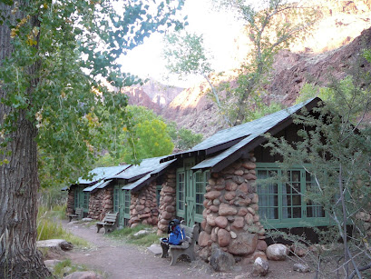
I do not have any photos of that trip.  What appear here are photos taken from a trip November 9-12, 2007; Chris and I hiked down the South Kaibab Trail to Phantom Ranch, stayed the night, and hiked back to the South Rim on the Bright Angel Trail.  The final photo, though taken from the bridge to the Bright Angel Trail from Phantom Ranch, encapsulates the grandeur of the canyon.  

Here is the passage map:  https://aztrail.org/wp-content/uploads/2018/01/38_GrandCanyonInnerGorge.pdf


Thursday, August 6, 2020

Arizona Trail: Passage 32

June 22, 2013
Richard and a friend from the Arizona Trail Association


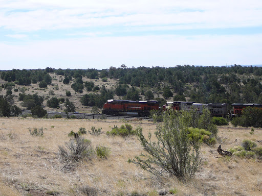
The first section of the trail, after the culvert under U.S. 40, parallels the railroad track for about a mile and a half.  The land is flatter and includes some volcanic soil.  After crossing U.S. 89 beyond the Rio de Flag footbridge, the trail loops around Mount Elden before climbing to the Shultz Pass trailhead at the end of the passage.  The weather, as the pictures show, was temperate and sunny.

Wednesday, August 5, 2020

Arizona Trail: Passage 31

The Arizona Trail junction below Fisher Point (2020)

Walnut Canyon Passage
July 13 and 15, 2020
Chris, me.  Weather:  clear, high 70s to high 80s both days.

We did a portion of this passage in two sections:  on July 13, we hiked from Marshall Lake to the trail junction with the Walnut Canyon Trailhead (7.2 miles one way).  On July 15, we took the Walnut Canyon Trail to the junction, then hiked out to to about 1 and a half mile farther, below Fisher Point (about 3.2 miles two way total).

Walnut Canyon Trail and AZT junction (2020)
In general, this was by far the most well laid-out and well-maintained section of the Arizona Trail that I have yet hiked.  The Ponderosa pine woodlands south of Flagstaff are open and simply enjoyable to walk.  The trail had recently been rerouted (?), and the switchbacks were gentle.  Only in the drop to Walnut Canyon was there a significant elevation change.  The views and wildflowers were superb.  However, the reroute seems to have added a significant distance to the trail, at least according to the trail signs, which listed Marshall Lake as 4.2 miles from the junction [see the picture].  (This made for a total of over 14 miles of hiking on July 13).

On our way home, we started at the Canyon Vista Campground trailhead, and hiked the Walnut Canyon Trail to the junction, and a mile or so farther on the Arizona Trail.  We seem to thus have hiked about 8 miles of this passage (which is listed at 17.9 miles total to I-40).
(2020)
(2020)
On both days of hiking, the midday temperatures felt very hot at the altitude; it was good that we had enough water.  Wonderful rock formations and wildflowers.


July 12, 2023
Walnut Canyon access road to I-40 terminus of the passage
Chris, me

The San Francisco Peaks, with the Arizona Trail in the right foreground (2023)

On the day we visited Walnut Canyon National Monument, we took a short (approximately 2 1/2 mile) hike out and back to the end of the passage at the Interstate 40 underpass. Because we began early, the temperatures hovered between the high 70s and the mid-80s, and clear. This section is primarily open piñon pine forest, with plenty of views. We did meet one mountain biker who had hiked the trail, and is now transitioning to riding it. He mentioned preparing to ride the sections north of Flagstaff, south of the Grand Canyon. Unfortunately, I neglected to get his name.

Terminus of the passage (2023)


(2020)

(2020


East of the Fisher Point junction, on the canyon trail (2020)


Grandpa Does the Arizona Trail: Passage 30


Upper and lower Lake Mary from Anderson Mesa (2020)

Anderson Mesa Passage

As of July 2023, I have completed the Anderson Mesa Passage, which I seem to have hiked in three installments over about thirteen years. I will be describing this passage from south to north, instead of chronologically.

July 11 and 13, 2023
Sleepers on the railroad grade (2023)
(Chris, me.)
On July 11, we hiked from Mayflower Spring to West Weimar Springs Road. The day became hotter in the two miles between the passage start at Mayflower Spring and West Weimar Springs Road. Still the same mix of open park and ponderosa woods as we skirted the hillside north of Mormon Lake.

The explanatory plaque (2023)


On July 13, we continued the hike from West Weimar Springs Road to Lake Mary Road (Chris, me) and from Horse Lake Trailhead to Lake Mary Road (me). The day's morning temperatures were in the 70s and partly cloudy--perfect hiking weather. After 10 a.m., temperatures rose to the 80s, and the sky turned mostly clear. At least half of the section we hiked on July 13 followed an old railroad grade, which had actually begun in the first two miles of the passage, hiked July 11th. About 1/10 of a mile northeast of West Weimar Springs Road, we encountered an explanatory sign, near a clear section of the railroad grade, where old sleepers remained in pattern. According to the sign, a railroad serving the logging industry and weekend Flagstaff vacationers operated here in the 1920s, most likely between 1924 and 1927. This section continued the landscape of open woods and sunny meadows; apparently the area is also open range--we encountered some groups of grazing cows near the trail.

Though the Arizona Trail is clearly marked, we did encounter one lost family group from the Pine Grove Campground, who believed they were following an out-and-back nature trail. Just past the turnoff to the Pine Grove campground, there is an underpass beneath the Pine Grove access road, though a half a mile farther on, there is no underpass under the Lake Mary Road. Apparently one has to scamper across to the AZT gate on the other side.


Once we had completed the return hike from Lake Mary Road, Chris drove me up to the Horse Lake Trailhead, from which I hiked down (for approximately 20 minutes) to the gate at Lake Mary Road. The forest road to the trailhead is a bit of a backcountry superhighway, with trailers and heavy trucks, as well as cars, at regular intervals. The trail from Lake Mary Road tends uphill and generally parallels the forest road. As a result, there was at least one concerning encampment (complete with pirate flag and tarp-covered fenced enclosure) between the trail and the forest road, maybe 40 yards from the trail at its closest point.

Intermittent water on Passage 30 (2010)

May 29, 2010
(me, Richard Duerden, Ranger the dog)
San Francisco Peaks from Anderson Mesa (2010)
Horse Lake Trailhead (2010)
I was only reminded of this by Richard Duerden's records. I find that I have photographs from this date, but I don't seem to have written about this at all at the time. Richard has one note: "Ranger liked the water." The photos bear this out.


July 14, 2020
Chris, me.  Weather--sunny and dry, high 70s to mid 80s.

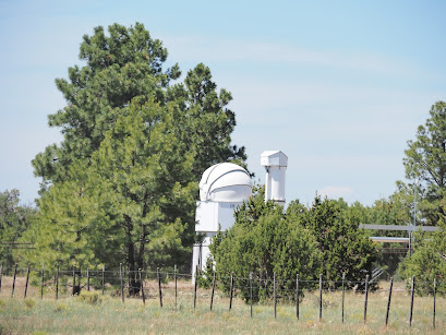
This was our second day of car camping at Marshall Lake.  On this day, we took the Arizona Trail from the trail junction at the south end of the lake further south on the Anderson Mesa Passage, hiking approximately 5 miles from the trail junction.  We ended at around Vail Lake at the Lakeview Campground Trail turnoff.  The trail was clearly marked, and took us around the Perkins Telescope and the Prime Lake refuge area, which was fenced off.  Approaching the edge of Anderson Mesa, there were great views of Upper and Lower Lake Mary.


Arizona Trail Gate at the northern terminus of Passage 30 (2020)


Lichen-covered rocks, northern Passage 30 (2020)


Perkins Telescope Complex, Passage 30 (2020)

Monday, August 3, 2020

Grandpa Does the Arizona Trail: Passage 29

[Note:  the passage numbering begins to change again here.  Originally, this was Passage 30 (Mormon Lake), with two parts, South and North, about 36 miles long).  Now, the North section is the Anderson Mesa section.]


We've apparently hiked (and biked) this section on several dates:
___________________________________________________________

July 10 and 11, 2023

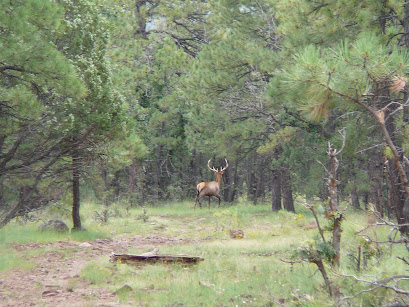
Setting up camp at the Double Springs Campground, on these two days, we out-and-back hiked the section of trail around Mormon Lake, to a bit over half a mile past Marshall Spring south, and two miles past the passage endpoint at Mayflower Spring north. The weather, though hot in the sun, was generally comfortable. Most of the route is smooth trail, with few climbs or descents or rocky sections. The flora is pine woods, mostly ponderosa (a few spruce, a few piñon pines), punctuated by open parks, like much of the rest of the Mogollon Rim. The fauna, on the other hand . . . we saw many deer, both singly and in herds, and on the 11th, we spooked what looked to be a herd of elk on the hillside, bulkier and noisier than deer, but not so noisy as cattle. Just a few glimpses of dark brown coats and white tail undersides and rumps. Mayflower Spring was running.
On July 14, we attempted to complete the passage by hiking from where I thought we had stopped in September 2009, to just south of Marshall Spring. The problem was getting there. I had (as described below) mistakenly estimated that we'd gotten as far north as Navajo Spring (trail mile 527.6 in the AZT mapbook), which we tried to reach by car. Beware Forest Road 219! We first tried to get in from the east. After about 1/2 mile of decent gravel and dirt, the road turned into a rock garden that, even with me driving our XTerra in 4wd, we felt we couldn't sustain for the couple of miles it would have taken to get to Navajo Spring. We then attempted to come in from the west side, using FR 91 to 219 on the other side. Imagine our surprise upon finding 219 (though signed for Mormon Lake in 4 miles) in even worse shape than on the west side. We hiked from the junction on 219 to the trail, about 1.8 miles up the road, then put in 2/10 of a mile north on the AZT.

August 28, 2005 (a short section around Mormon Lake.)  We tried to mountain bike north from the Double Springs campground toward Marshall Lake, and south from the campground to the southern end of the lake.  I believe that we probably biked a total of two miles north, and about a mile and a half south, to Wallace Spring.

Notes:

We hiked/mountain biked at least some of this stretch around Mormon Lake  North of Double Springs Campground, the ground is pretty rocky and hilly.  South of the campground, the trail follows hill contours around the lake, sometimes steep.

6 September 2009
Richard, Jeannie, Sarah, Chris, Ranger, me.

Allen Lake Landing [on the Lake Mary Road] to, as it turns out, the confluence of Forest Road 90H with the AZT, near La Negrita Tank.  Temperature circa 80 and clear for most of the day, clouding to threaten thunderstorms in the late afternoon.  We walked about 2 [actually 8, according to hiking partner Richard Duerden's more accurate notes] miles of the trail, to spare the dog, who was on medication for arthritis.

This trail is completely clear, sometimes follows an old railroad grade, and would be perfect for biking, except . . .

This was Labor Day Sunday, and it seemed like everyone with an ATV and a gun was out in the woods.  There was so much engine noise and gunshot sound that the dog was spooked, and it felt more like an urban than a wilderness walk.

There's water at an unnamed spring just northwest of the Forest Highway junction, and also at Patch Tank.  If one were doing a through-hike, one could easily find water, I think.

2023 Final Comment:

It turns out that between 2005 and July 2023, I have hiked virtually the whole of the new Passage 29. I now know that in 2009, we got farther north than I had thought, to about trail mile 529 (see above). That leaves me with less than a mile of distance between FR 90H, mentioned above, and just south of Marshall Spring, where we stopped on July 10, 2023. Maybe I'll hike that bit in the future, but otherwise, it's been adjudicated that I can call this passage hiked.

Here is the passage map: https://aztrail.org/wp-content/uploads/2018/01/29_MormonLake.pdf

Sunday, August 2, 2020

Arizona Trail: Passage 28

Happy Jack Passage

 We seem to have done this passage in at least three legs:

 September 25, 2004:  Forest Road 211 to a road junction near Kenneth Tank.

September 16, 2006:  Bergaman Park to Allan Lake

August 22, 2007:  Bergaman Park to approximately Dave’s Tank.

 I seem to remember hiking (scouting) the short section between Forest Road 211 and SR 87, though I didn’t document it.


Notes:

 9/25/04  Sarah, Richard, Chris, me, Ranger

 Relatively flat, 70-80 degrees, climb out of initial dirt road.  Ponderosa pines, jeep road through Jack’s Canyon.  Ponderosa pines in thickets above canyon.

 No animals to see.  Clear day.  Nice country, easy hiking.  Biggest adventure—trying to take jeep trails back to main forest road.  Sarah got very frustrated and walked after a couple of miles.  Richard knocked out his cruise control.

 Saturday, August 22, 2007

 Chris, Richard, Sarah, Ranger, me

 Bergaman Park to approximately Dave’s Tank (changed route).  Day was partly cloudy to cloudy, c. 70-80 degrees Farenheit.  I had the strangest feeling of déjà vu when we got to the forst road junction east of Bergaman Park.  I would have sworn that I’d been there before.  Everything looked familiar, but nothing (like trail junctions) was where it “should have been.”  That feeling persisted throughout the day, but I’ve checked my records—I’ve never hiked that area before.  It must be similar to the scenery around Jack’s Canyon in 2004.

 The route has changed from the old topo version of the trail route.  I’ve marked where Richard and I thought it was.  I love hiking these woods—the forest roads crisscross the area and it’s pretty flat.  The Ponderosa woods are punctuated by great meadows (parks).  It’s hard to tell if the springs in the area would sustain a through hike that didn’t use caches.

Wildlife we saw:

2 herds of elk, 1 King Snake, several horny toads (!) and domestic cows.

 Ranger picked up a thorn or something that has infected his paw.

 I-17 was blocked on the return journey, and we came home via Pine-Strawberry-Payson.  We had supper at the Pine Mountain (?).  I’ve now travelled the Stoneman Lake Road (busy) and the General Crook Trail (deserted).

9/16/06

 Bergaman Park to Allan Lake.

 Open Ponderosa Pine forest, mostly flat.  Perfect weather—Blue sky, low humidity, 75-85 degrees.

 Bergaman Park is a huge meadow (1/2 x ½ mile?).

 Saw an elk, which we chased (unintentionally) down the trail.

 Richard’s Birthday—beer and carrot cake in the woods.


 (These pictures are all from the August 25, 2007 hike.)


Saturday, August 1, 2020

Arizona Trail: Passage 27

I have perhaps hiked on this passage more times than any other single passage of the Arizona Trail (maybe with the exception of the Mazatzal passages).  Here are my notes from the various times I've hiked it, from 2001-2020; the photos will be from Arizona Trail Day (in the Fall of 2019) and Chris's and my trip in 2020 during the COVID pandemic (physically-distant camping).
___________________________________________________________________________

The Notes:


Arley, Donna, Richard, me

June 23, 2001 (dayhike). 

 Began 9 a.m.  Temp mid 70’s-80 with 10 mph breeze.

 Dusty herbal smell of pines.  Wild roses, Indian paintbrush, bridal lace (?) etc.  Small blooms, nothing big.  Partly cloudy.  Started at General Springs historical marker where FR 300 intersects with See (?) Canyon trail.  Follow springs canyon toward Blue Ridge Reservoir.  Plenty of pools in Spring Canyon.  Winds in the pines, bird calls.  How to explain bird calls without clichés?  Trilling arpeggios.  Easy, great hiking along the creek.  General Springs Cabin at the beginning of the trail (built 1912).  Plexiglass windows in old wood frame.  Battle of Big Dry Wash historical marker.  General Crook vs. Apaches, 1882.  (Crook won. –2 soldiers, -20 Apaches).  Total one-way trip--3 miles (6 miles total out and back).


 Perfect day – partly cloudy, open shade

 Yellow columbine, dragonflies along creek, blue, red, and black.  Large water beetles in pools, water skimmers, tadpoles.  (Green notebook)

 July 15,  2006 Blue Ridge/Moqui Campground

 Scouted about 2 ½ more miles of the AZ Trail.  Gently rolling, or pretty flat, trail through oak and ponderosa pine forest.  Near the campground is a stand of aspen.

The trail is easy for a little while south of the campground, but then climbs a ridge.  The rock erosion dams make it extremely difficult to ride either up or down.  I quit after ½ mile south.  (Yellow notebook).

 Turns out the trail goes right past/through Blue Ridge campground.  The campground itself is excellent—fire pits, grill setup, cement benches, graveled level tent pads, big trees.  The washroom is the cleanest one I’ve ever been in!

 October 12, 2019--Arizona Trail Day with Richard, Sarah, Chris, Jeannie.

May 29-30, 2020

 Covid camping with Chris.  Camped at Rock Crossing trailhead (that is, nearby, maybe ½ mile).

 Day hiking passage 28 of the Arizona Trail (Blue Ridge Passage).


May 29—Hiked south to the place where Richard and I stopped on Arizona Trail Day (intersection with FR 212A?).  Rock Creek Canyon is gnarly—very vertical.  One way was over 5 miles (over 10 round trip).

May 30--Hiked north to the entrance to the Moqui Campground, which I had scouted earlier.


Here's the passage map:  https://aztrail.org/wp-content/uploads/2018/01/27_BlueRidge.pdf