Here is the link to a revised video I created for a Grand Canyon University class--ENG 365--Multimedia Journalism for the 21st Century.
https://www.youtube.com/watch?v=Xdj7AY_mQ2M&t=71s
I would have loaded this into the blog, but it's too big for Blogger.
Wednesday, December 13, 2017

Tuesday, November 7, 2017
Review of C.S. Lewis and the Middle Ages
I had written this review for Sehnsucht: The C.S. Lewis Journal, but it turns out they had already published one. So . . .
Robert Boenig, C. S.
Lewis and the Middle Ages (Kent, OH, 2012).
Viii + 181 pages. ISBN:
9781606351147.
Norman Cantor, in Inventing the Middle Ages (1991), takes
an outsider perspective on the careers of C. S. Lewis and J. R. R. Tolkien,
painting them as nostalgic for the zenith of the British Empire, and seeing
their primary importance to medieval studies as their fiction. Robert Boening, by contrast, takes an
engaging insider’s view of C. S. Lewis’s personal and professional relationship
to the medieval world.
Boenig’s introductory overview
attempts in miniature what Cantor attempts in a mid-length volume, and does an
excellent job of explaining the milieu of medieval studies from the
mid-sixteenth century to the middle of the twentieth, to contextualize Lewis’s
career. His description of the initial
interest in the Middle Ages by the early English Reformers (resulting in the
preservation of many Anglo-Saxon and Middle English texts) connects Lewis’s
religious concerns to the field of medieval studies itself. His explanation of the roots of the current
academic discipline—its origin in Victorian cultural and literary fashion, and
the political appropriation of the Middle Ages by some of the authors Lewis
appreciates (especially William Morris)—contextualizes not only Lewis, but also
the vogue for medievalism that animated Lewis’s early reading.
Chapter one, “Lewis the
Medievalist,” focuses on Lewis’s academic career and activities relating to the
Middle Ages. The point of the chapter can
be summed up by saying that Lewis’s scholarship attempted to colonize the Renaissance
with the Middle Ages. Boenig makes the
case that Lewis found a great worldview affinity with the Middle Ages, and took
as his scholarly project the contemporary explanation of the worldview itself
for his contemporary audience, showing the interpenetration of the Renaissance
with medieval modes of thought and literary expression.
The subsequent chapters connect
Lewis’s understanding of the medieval worldview with his notion of Joy, and
with both the images and structures of his fiction. One of the most fruitful insights of these
chapters is that Lewis conceived of medieval creativity as dialogic, in which an
author appropriates and remakes prior texts.
One sees this most easily in such works by Lewis as The Pilgrim’s Regress and The
Great Divorce, but Boenig makes the case that medieval modes of creativity
permeate Lewis’s creative writing in a variety of ways, which he describes in
detail.
The comprehensive discussion of
this mode of medieval creativity provides the reader with an important support for
the arguments of Michael Ward’s Planet
Narnia; one problematic element of Ward’s argument involves his assertion
that the medieval cosmological pattern that he sees was intended by Lewis. Since Ward himself makes the point that Lewis
never explicitly mentioned such a pattern, one might ask whether the pattern
resides in the mind of the reader only, rather than the author’s intention. Boenig’s discussion provides a context to
argue that Lewis’s mode of creativity could easily accommodate an implicit
“dialogue” between Lewis and medieval cosmology in terms of his Narnian fantasy
world.
The book is well-structured and
written, engaging to both the layperson and the academic with an interest in
Lewis. It paints an excellent portrait
of Lewis as a medievalist and an appreciator of the period. Boenig’s conclusions and analyses are
fruitful to further scholarship on Lewis’s relationship to the medieval period
and are interesting in themselves, making this volume well worth reading.
Tuesday, May 9, 2017
Mesa Canals 15 (plus, an update of Mesa Canals 11): To Riverview Park and Beyond!

May 9, 2017
What follows is a quick review of a canal-based route to Priest Drive in Tempe, using routes that I've described in Mesa Canals 3 and 11. First, Mesa has undertaken to improve its street bike routes as well as the canal routes greatly over the past several years (thanks, Mesa!), so the routes that I did several years ago are now all paved (mostly concrete, but some asphalt), and the intersections are at least signed, but sometimes signaled as well. The section described in Mesa Canals 3 has now been extended to Country Club; I got a preview (that is to say that the paths I took were signed as closed), so you will want to wait for a month or two before trying them. They are installing signals at Mesa and Country Club drives, and have completed on-street bike lanes. However, there are still protruding small standpipes in the center of the street-bike lanes that will have to be fixed before they open officially. After crossing Country Club, the separated street lane continues down West Brown Road until 10th Street, where the route turns off. At the 10th Street-Alma School Road intersection, a separated bike lane continues up Alma School to Bass Pro Drive, where there is a signal.
Go down Bass Pro Drive to the roundabout, then wind through the Bass Pro Shop parking lot, closest to the freeway. Come out of the driveway to the Jimmy Johns exit lane, then straight up Dobson until it ends (it's a little freaky to cross the mouth of the exit ramp, though there is a signal). On the river side is the entrance to the Salt River bike path.
From there on it's paved bike paths to Priest Drive. The initial stretch (Riverview Park, Mesa to Tempe Marketplace) does not have any road crossings; the path takes some underpasses under the 202-101 interchange. You will pass a Salt River bird refuge, some overflow (?) settling ponds from the sewage treatment plant near the new Cubs spring training ballpark, then under the various freeway ramps (very interesting to see one's commute route from a different angle). The first street crossing is McClintock, at one of the entrances to Tempe Marketplace (it looks like an underpass is not planned for that area).
Once you pass McClintock, you're going past Carsten Golf Course, then past the newly constructed highrises near "A" Butte. The view is impressive--Tempe Town Lake, spanned by bridges, an expanse of shining water, bordered by parks and tall buildings (with more on the way, judging from work that's taking place east of Rural). Though the view is impressive, one still wonders about the lake and the development; there's something incongruous about a lake in the desert, which makes Tempe look a bit like the River Charles near downtown Boston. That's accentuated by the tall buildings that obscure "A" Butte and Sun Devil Stadium. Call me old-fashioned, but I did prefer the butte and the nestled stadium to a monument yard of concrete and glass blocks. But, yes, I know that here is the only place Tempe can build upwards, without running afoul of the FAA and the Sky Harbor approaches. But did they have to be almost as tall as the butte?
I digress. The last few miles past the high-rises to Priest Drive start out scenic. Note a few shapes drawn by my out-and-back route: the paved path (I did use my road bike) is bordered by a packed small gravel path for runners. It is not always clear where to make the switch when there are road crossings or access to buildings (magnify the section between Carsten and Tempe Beach Park).
Past the Tempe Center for the Arts and the bridge over the lake near the dam, a crew was working on what looked to be an underpass under Priest Drive on the south side. The path was closed at this point. Foolishly, the only pictures I took were right here (there are many more photogenic spots on this ride).


From here, I backtracked to the bridge, which I crossed, then checked the paved path on the north side that also ends at Priest (maybe some other time for the trip north on the Indian Bend Wash path). The bridge is a great view both ways.
After backtracking, I took an alternate way out, through Riverview Park (see the tail on the Google Earth picture). Take the right fork in the path west of Dobson; you'll find yourself in a parking lot abutting the sewer treatment plant. After finding the path on the east end of the parking lot, cross the street and thread your way through the paved paths in Riverview Park to the intersection of Dobson and Rio Salado Parkway. Either of those two roads will take you anywhere you want to go.
May 20, 2023
It has taken a long time to get back to this section. Technically, this is not Mesa Canals any more; when we hit Tempe, it's the Tempe portion of the Salt River Path, which is said to run to Central Avenue at the Salt River and maybe beyond (the Google Earth image is not completely clear). The approximately 2 1/2 miles more that we took past the closed Priest Drive underpass described above took us to approximately south of the terminal area of Sky Harbor airport, past the 143 Freeway. The trail to this point has been well-improved, with access points, underpasses and shade structures. We (Lex, Jeff and I) stopped at this point, primarily because the day was getting hotter, and we would have done 30 miles total for the morning. At some future point, we plan to start at Tempe Marketplace and try to complete the trail to where the improvements end, or to Central Avenue, whichever is farther.
 |
| The extension, May 20, 2023 |
Friday, December 23, 2016
Arizona Trail: Passage 5
On the way back home September 1 or 2, 2013, we went down Forest Road 163 (with a short detour on Forest Road 4085), to see Kentucky Camp on the Santa Rita Passage. We hiked a short distance on the trail itself, and explored the mining buildings. Some of the buildings can be rented, and while we were there, had occupants.


 Here's the passage map: https://aztrail.org/wp-content/uploads/2018/01/05_SantaRitaMountains.pdf


Arizona Trail: Passage 3
We first looked at the Canelo Hills West Section on our way to Patagonia from Parker Canyon Lake after starting at Montezuma Pass near the Coronado Monument on, probably, September 1 or 2, 2013. As we passed down Forest Road 58 into Patagonia from Parker Canyon Lake, we passed the Harshaw Road Trailhead.


On October 30, 2022, Chris and I hiked the section from Patagonia to the Harshaw Road Trailhead, documented in the latest large-scale map book. This was the original trail alignment. The passage map below shows the revised alignment, with Harshaw Road as the connector to the Canelo Hills West section. Since I actually like the old alignment, I'll probably hike in/out on the Harshaw Road connector, to connect the Temporal Gulch Trailhead with Passage 3. Not much has changed at the trailhead as the picture below shows, as we hiked out via the road (which is scenic enough, but possibly somewhat hazardous, if there were higher traffic levels). Also interestingly, we saw several discarded camo jackets along the road. At first I thought "How strange that hunters would leave their jackets along the road . . ." then, "Oh . . . I get it." Yet another sign of border ironies: One can see in Sonoyta, Sonora the stands selling camo jackets for potential border crossers. This is where they end up when people discard them before entering town. It does make one wonder whether or not the Arizona Trail itself is sometimes a route.
 |
| The trail junction across Harshaw Road |
 |
| Harshaw Road Informational Sign |
 |
| Street crossing warning |
 |
| Reroute Information |
Sunday, November 6, 2016
Arizona Trail: Passage 1

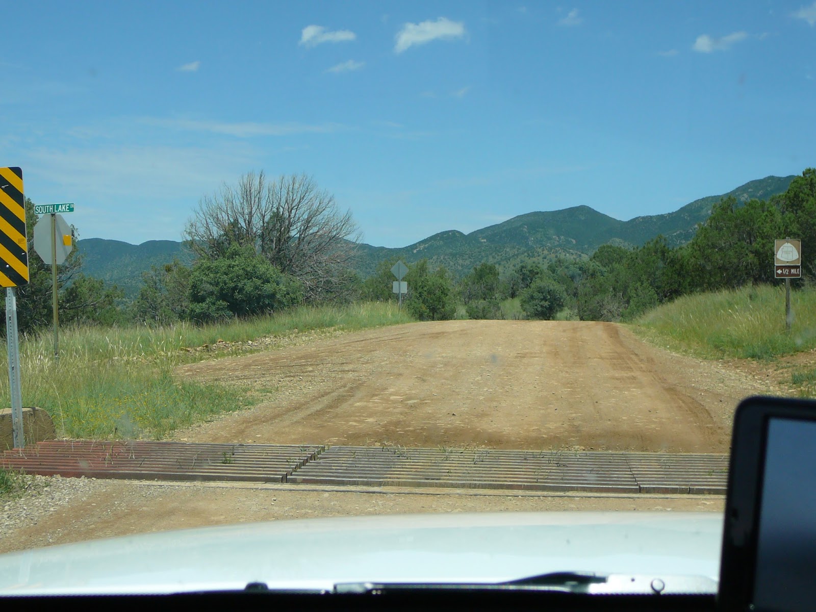
This is the beginning of a series that I intend to finish by chronicling all my encounters with the Arizona Trail. I've decided to go in passage order, for the passages I've visited. Some, like this one, I've only sampled by driving through by car and stopping. This stop was on September 1 or 2, 2013, as Chris and I returned from a wine-tasting weekend around Sonoita. I had decided to take the border-paralleling highway East Montezuma Canyon Road, and we stopped at the overlook. Though we didn't actually do much hiking, we stopped at a number of trailheads on our way back through Patagonia (Patagonia Lake, and Patagonia itself). As I explore more fully, I'll enter more.


Sunday, February 28, 2016
Mesa Canals 14: Consolidated Canal to Coffee at Bergies in Gilbert

I can't believe that it's taken me almost two weeks to write this down: I'll put it down to the flu (apparently, Arizona's the nationwide epicenter this week). I also can't believe that this is the first Mesa Canals post in almost a year.
Anyhow, this is a great trip that I realize I haven't documented anywhere in this series, though it does intersect with Mesa Canals 10: the Sun Circle Route for the last westbound mile.
First, this is the Consolidated Canal, which runs northwest to southeast roughly paralleling Gilbert Road. I'd ridden this canal route before it was paved, and before the installation of traffic lights at most of the major street intersections. Before these improvements it was iffy, and now it's approximately 8 miles of ease between 8th Street/Adobe and Bergies Coffee on Gilbert Road in downtown. Almost the whole of the distance is paved, and almost all of the major intersections have special bike-pedestrian lights. The two that don't (on the southern end of the route) are a little concerning, but can be used with care.
It was also a great morning, though it turned out to be unseasonably cold (probably the last time anyone will say that this year, though here's hoping). It was a post-race warm down for Monster Media rider Beth Everhart, her Fasturdays and life partner Steve Cullen, cousin Yancy Everhart, friend Adam Burleson and me. The East-coasters turned out to be more thin-blooded than one might think, but the sun was warm and the coffee was great!
P.S. Beth took 3rd in the Senior Women Valley of the Sun Stage Race GC!
Subscribe to:
Posts (Atom)