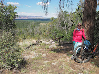
On September 21st and 22nd, 2023, Chris and I completed about 12 miles of Passage 34, hiking ten and a half miles from south of Schultz Tank to the Snowbowl Road. The next day, parking at Snowbowl Road, we did around a mile and a quarter out and back northbound on the trail (this second day was a concession to the complications of dropoff and pickup at trail junctions, and previous overenthusiasm during the mountain biking sections.
On the 21st, we parked at the Snowbowl Road and called a taxi (!) to take us to what we thought would be the Schultz Tank Trailhead. [By the way, shout-out to Turquoise Taxi (928-600-2112)!] But it turns out that eastbound Schultz Tank Road in northwest Flagstaff has been closed near its entrance because of forest fire and flooding damage. It also turns out that Little Elden Road, which usually reaches up to the Schultz Tank Trailhead (which I had driven to during my hike of Passage 32), is now closed about two and a half miles below the trailhead. Turquoise took us as far as the closed-road gate on Little Elden Road. This turned what we thought would be a 7 1/2 mile hike into about a 10 1/2 mile hike.
We also needed to find the trail from the road. As can be seen by the route on Route Scout (https://hikearizona.com/map.php?TL=209963), the sharp right angle bend off the road is the place where we left the road and bushwacked to the Arizona Trail. There, we experienced our second instance of Native kindness, when a Native man who was cutting wood for his grandparents (part of the fire clearing program in the national forest) saw us get out of the taxi and stand around puzzled. His hunting mapping app showed where the Arizona Trail was, and confirmed Route Scout. He also encouraged us that the trail was really very close and easy to find. He must have heard my murmured "Ya-ta-he" (I thought that on balance he was probably Dine'), because he came back with two ears of pit-roasted and smoked corn from his family corn field on one of the Hopi Mesas. He said, "These are for your journey." I didn't know the word then, but now I can say to him "kwakwhay" (thank-you). It was an important blessing to receive. The corn was delicious that evening.
The rest of the day went smoothly, though the portion of Passage 32 that I had hiked many years before had been rerouted in some places, mostly up and across burned-over slopes prone to erosion. We climbed on the trail to Schultz Tank, meeting a party of equestrians on one of the slopes. We got to Schultz Tank (below) soon after lunch, seeing some small water troughs first, before seeing the tank itself. Though the roads all seem to be closed, there was some presence of RVs and camps in the area. Signs proclaimed that forest restoration was the reason for the camps in the area.

Once on Passage 34 proper, we often hiked alone, though by midafternoon, we began to be passed by mountain bikers, who seemed to have come up from a number of spur trails in the Flagstaff trail system. We probably were passed by around 8 cyclists, mostly in pairs. The terrain, though rolling, did not have any huge descents or climbs, and the trail itself was clearly marked and not too rocky.

The 22nd was our last day of hiking before leaving for home. Originally, I had planned an 11-mile day on Passage, to Forest Road 417. But our week of experiences, including our shuttling issues on the first part of Passage 34, had convinced me that discretion was the better part of valor in this case, so we contented ourselves with hiking 1 1/4 miles northbound from the Snowbowl road (a 2 1/2 mile round trip). We then headed for home in Mesa.


